Yarrabilba Urban Development
Spanning approximately 2,000 hectares, the Yarrabilba Urban Development Area represents a significant State urban planning initiative in South-East Queensland.
Technology is moving fast, at Austecology we strive to remain at the forefront of implementing new innovations to provide more for our clients.
Our thermal drone surveys for koala and greater glider deliver higher-quality ecological insights while significantly reducing costs compared to traditional ground-based methods.
Traditional survey approaches for koala and greater glider previously required large teams to conduct walking transects throughout suitable habitat in search of evidence and animals.
Integrating drone technology has greatly enhanced our ability to detect these elusive species, particularly in areas with low population density.
This increased efficiency allows us to deliver large-scale koala and greater glider drone surveys at lower cost and with higher detection rates, giving clients greater confidence in their environmental management strategies and regulatory compliance.
Drone technology significantly improves survey efficiency by enabling our ecologists to rapidly cover extensive survey areas, with coverage on an average thermal drone survey being measured in the hundreds of kilometres. A recent offset monitoring survey in Central Queensland conducted for Glencore, for example, achieved 440km of aerial thermal drone transects complemented by over 50 hours of targeted ground-based searches. This combined approach integrates aerial and ground survey methods to maximize results.
Safety is always our top priority, so our ability to access difficult-to-reach areas to deliver broad coverage without compromising on safety makes our aerial surveys for targeted fauna an invaluable asset. Our team includes a CASA-certified chief remote pilot with extensive experience in designing and implementing aerial surveys for threatened species, ensuring that all our operations are compliant, safe, and ethically conducted.
Our team continues to effectively implement drone surveying in our field programs, delivering substantial benefits to our clients across a variety of sectors and target species.
Austecology’s large-scale Yarrabilba Urban Development project for Lend Lease serves as a compelling illustration of the advantages provided by thermal drone surveys in Queensland.
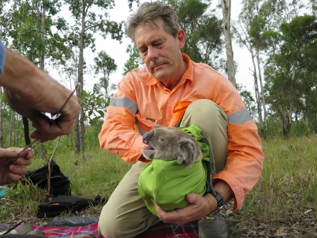
For this project, drone-based monitoring has been integrated as a valuable enhancement to the existing monitoring program, supporting EPBC approval requirements through comprehensive site-wide population surveys and regular health assessments.
Previously, surveys that required four personnel conducting extensive ground transects can now be completed by a single drone operator. Additionally, the drone’s telephoto camera allows individual health assessments with minimal stress or disturbance, and its powerful zoom clearly identifies coloured ear tags for effective monitoring over time.
At Austecology we remain committed to leveraging technology to achieve practical, cost-effective results for our clients. Get in touch to discuss how our wildlife drone surveys in Queensland can support your project.

Spanning approximately 2,000 hectares, the Yarrabilba Urban Development Area represents a significant State urban planning initiative in South-East Queensland.

Seafarms Group Limited proposed to develop a substantive aquaculture project located on the Legune coastal floodplain within the extreme north-west corner of the Northern Territory.

The Coomera Connector (sometimes referred to as the Second M1), is a future state-controlled road extending some 45 kilometres from the northern Gold Coast to Loganholme.